In 2015, a Friends of Aden volunteer, Derek Jennings, was out walking his dog, Morlich, through the woodlands in the park. As Morlich wandered further into the trees Derek spotted some unusual bumps on the ground. Derek thought this may have been the lost Keith Castle and discussed his findings with several archaeologists; Ali from Cameron Archaeology took on the challenge and got a team together to investigate the features.
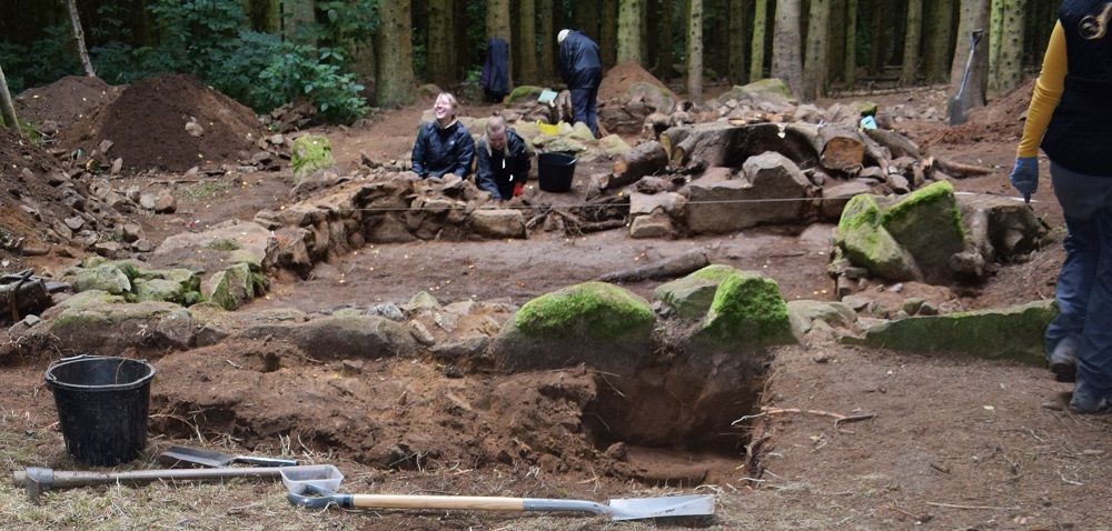
Following an evaluation in 2015 and an excavation in 2016, the foundations of two stone structures, previously thought to be the remains of an Episcopalian Meeting Place, were discovered in the woodland near to Hareshowe Farm in Aden country Park. A further dig was then carried out in September 2019.
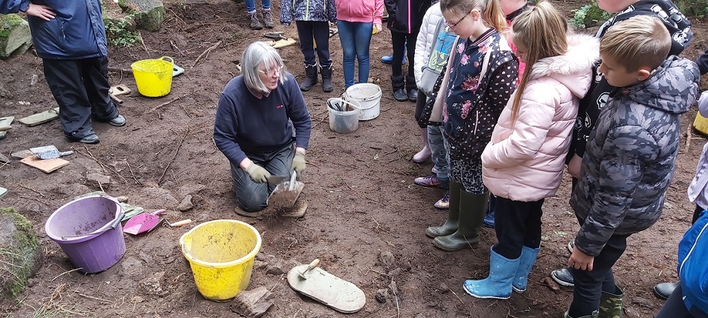
Volunteer Heather Jennings demonstrating archaeology techniques to local school children
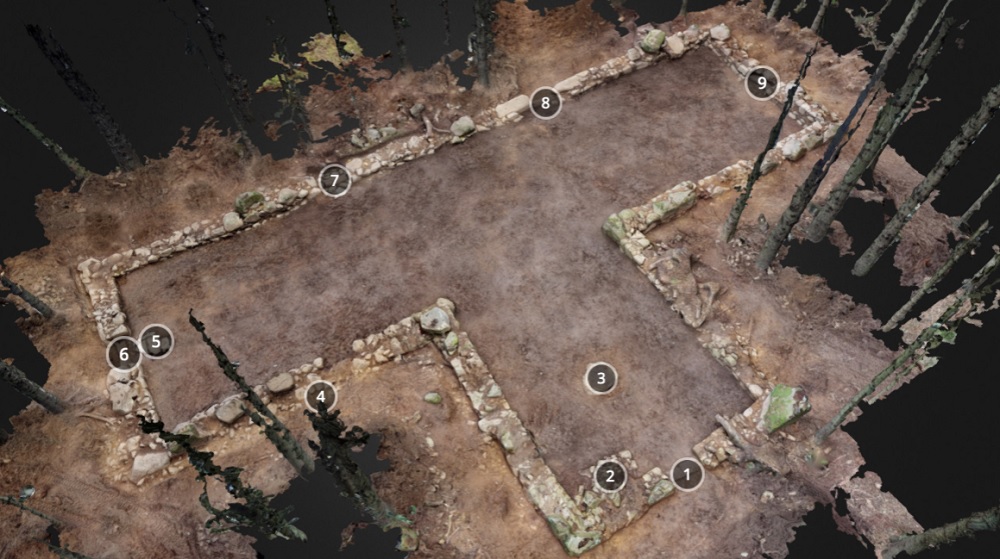
A T-shaped building was uncovered during the course of the dig. The building had five doors in total, two on the south wall, one on each of the west, east and north walls. One used large boulders for the lower jambs and the theory was that this was the earliest door but there is no other evidence for this. The door on the west wall was latterly blocked.
T-Shaped Structure 3D modelling screenshot from Orbital Scot
As part of the archaeological dig, Maria and Ewen Sinclair – Orbital Scot, were invited down with their 3D modelling equipment to help record the archaeological site. The screenshot above is taken from Orbital Scot Aden Sketchfab page.
The key for the above image is as follows: 1. North Door 2. Base for stairs 3. Preacher Stone 4. Demolition Rubble 5. Remains of Cobbled Floor 6. East Door 7. South Door 8. Earliest Door 9. West Door (Blocked)
Finds discovered during the excavation included 17th-century coins, brooch, spectacle frames and lenses, window glass but no domestic rubbish – no pottery, vessel glass or bone. The first phase of window glass dates to the 16th Century or early 17th Century and the second glazing phase in the mid to latter half of the 17th century. The coins mainly date to the 17th Century. The burnt wood on the floor was dated to 17th to mid-18th Century and therefore the building could have been burnt down in the mid-18th Century.
The building had been completely dismantled to ground level including removal of all flooring apart from small areas of cobbles around the doors and this might suggest that there had been a wooden flooring within the building. The stone settings in the west wing of the building may have been remains of supports for wooden flooring. It is also possible that a stone slab flooring been removed during the extensive demolition.
The Southeast corner of the building appears to have been rebuilt which begs the question of how was the building originally constructed. In a later phase, large stones have been placed on the bank created by the demolished building, possibly decades after the demolition; these may have been set out by the later estate owners (Russel family) or by antiquarians who remembered the building and wanted to mark and commemorate it.
Volunteers hard at work at the rectangular structure
Just beside the T-shaped building lies an associated c14.6m long and c4.6m wide rectangular building. The walls are constructed of large, medium and small stones bonded with sandy clay, very similar to the T shaped building. The south room has a hearth on the South wall with cobbled surface around and an earthen floor around the periphery of the room. The fireplace is not aligned correctly for a flue through the South wall and therefore has been interpreted as a hanging lum.
There is a door with threshold in the North end of the East wall. There is also a door through the wall between Rooms 1 and 2. The West wall of Room 2 has a recess which has been possibly interpreted as a niche for a box bed. There is a stone-lined pit in the Northeast corner of the room which was constructed after the building went out of use (and presumably after it had been demolished). The pit is associated with a small fire-pit, thought to be a corn-drying kiln.
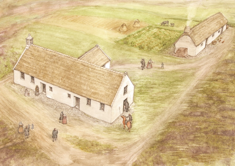
Possible post 1500s (post-reformation) chapel and associated rectangular building (by Jan Dunbar)
In terms of interpretation, as the illustration by Jan Dunbar above shows, the T-shaped building could possibly be a post 1500s (post-reformation) chapel, one storey, with a thatch roof, however research is still ongoing. The building would have been large compared with the others in the area and we estimate that it could have held over 100 people.
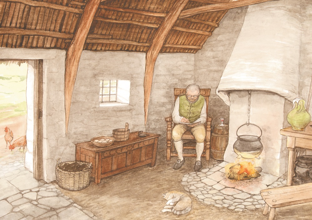
Possible interior of rectangular building (by Jan Dunbar)
As shown in the illustrations above, it is thought that the rectangular building could possibly be a domestic structure at the South end and possibly agricultural at the North end of the building. There is a tradition of a country manse which would have included accommodation for the minister as well as garden and fields for supplying the table of the minister and family.
For further information about the T shaped and rectangular shaped buildings, please download the attached Data Structure Reports (DSR) and summary reports below, however please be aware that these reports are large in size and depending on your internet connection, might take a few minutes to download.
It is important to note that the T-Shaped and Rectangular Building research, dig, and Data Structure Reports (DSR) has only been made possible with funding support from the National Lottery Heritage Fund (NLHF), Historic Environment Scotland (HES) and support from Aberdeenshire Council itself.

